• Welcome to the Yamaha FZ6 Forums. Member registration disables ads and allows you to post and share. Register Here.

UPDATED: Socal Fires... Newcomb gone!?!

I'm in...I rode Newcomb 2 weeks prior to the fires and the road was covered in debris. Might have to sweep the road first. Anyone ever attach a pushbroom to the front of their rides?
 
Ride would be good, might be a little depressing with all the devastation.
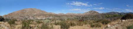
I went for a little ride out around Acton and ended up on Aliso Canyon and here are some shots from the area.
Firefighters were really on top of it in this area as it looks like they saved most of the homes in the distance--
P1010893.jpg

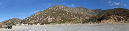
Looking toward Angeles Forest Hwy--
P1010895.jpg

At the intersection with Angeles Forest Hwy--
P1010902.jpg

Not a pretty sight:(

Jerry
 
Cool photos...

Something I read this morning:

=============================
Guys,
FYI...

I was out riding in Palmdale on Sunday and, on my way home, I got a wild hair up my Butt, and I decided to try to ride up to Newcomb's.

I made it half way up the 9 mile, before I was stopped by trucks in the road and someone that was either a worker or a guard. He asked me what the hell I was doing, so I told him I was going up to check out Newcomb's. He asked me if I could read, because there are bunch of signs that say the roads are closed. I told him the signs say closed to thru traffic, and that I did not plan on going through. He wasn't happy, so I turned around and went back.

The ride up there was very eerie. There is a lot more visibility, since there are no trees and brush left. Very little animal activity. I only saw 3 birds and one squirrel. Everything was brown except for the black trees. The smell of smoke was minimal. It looked like something out a Terminator movie.

Angeles Forest is officially closed at Mt Emma. Halfway between there and Aliso Canyon, is were the fire came down to. All the guard rails are gone from Angeles Forest, even at the lower level. The road surface was fine, except that there were many places were rockslides occurred, and I guess since there has not been any traffic, the stuff just stayed on the road. Most of the stuff was grape size rocks and gravel, but there were a few locations that had softball size debris, and some places had rocks the size of football, mixed with gravel. I could not go real fast in the turns, because I had no idea what was waiting for me around the blind corners. The 9 mile was cleaner after the first 1/4 mile, as far as rock and dirt debris. The pavement was not burnt either, but all the guard rails were gone.

I was happy to see that they are already doing repairs. They installed new guard rails on about 70% of the lower half of the 9 mile. I'm not sure what's going on up at the higher elevation, but I was excited to see that they actually started repairs.

I guess they will eventually get it back open, but since they have not even started replacing guard rails on Angeles Forrest, it will still be a while. They had cones up at all the turns on Angeles Forrest. I have no idea why, unless they have road crews working at night?

It was really cool having the entire road to myself.
============================
 
John,
Has anyone ridden up there recently? Is it closed?
It looks a lot like it looked down here(Borrego area) during the Witch Creek fires. We've had so many fire these past years it's hard to tell which fire did what.
Edit: Just started reading Daves post....

Still closed and will be for quite a while. According to the US Forest Service website Angeles Forest will be closed until next year. Angeles National Forest - Forest Orders

Click on the link marked Station Fire Recovery Order. The order is good until September of next year though I think it'll be open before then.
 
FYI... Angeles Crest, Hwy 2, is reopening Monday (Nov 30th), Be watchful of falling rocks! It will likely close again if it rains or snows.
:rockon:
 
So...I rode the 2 today in my normal carpool route (or at least what was normal before the Station Fire) from Palmdale to La Canada. The North route over 2/Angeles Forest Highway was very clean (and I learned was maintained by LA County Public Works). LOTS OF guard rails and concrete barriers, so much so, I consider them a danger to rider who want to push their bike and find themselves sliding across pavement into one of these barriers. On the South side, 2/Angeles Crest Highway (~9 miles to La Canada), there was literally tons and tons of debris. Rocks, boulders, dust, dirt, bushes and trees. So much so, I'd consider CalTrans' work on that side of the mountain intentionally (and criminally) negligent. I have video on my facebook account taken with my iPhone of on that side of the mountain. So, my recommendation for SoCal riders, wait until the weekend, let CalTrans get back to wiping up the road again, and be aware. The golf to baseball sized rocks seem to be getting blown off the mountain. Just about all the well known structures along the route were burned down to the ground.
 
Back
Top