• Welcome to the Yamaha FZ6 Forums. Member registration disables ads and allows you to post and share. Register Here.

Caladin's 2010 trip: Arctic bound

Caladin

Junior Member
Joined
Mar 24, 2008
Messages
175
Reaction score
23
Points
0
Location
Abbotsford, BC, Canada
Visit site
I have wanted to travel up north for some time. But to go where I would like I needed time off in June-August. My job does not give me the option of taking time off in the summer for the time being.

However this year due to the Vancouver Winter Olympics I lucked out and was able to grab some days off in July!

I had a plan of either touring around Alaska and riding the Dalton Hwy, or I could do a little of Alaska much of the Yukon and the Dempster Highway.

I planned out 2 different general routes for this trip and decided that I would let the weather decide what one I should do. Should it be raining while in the Yukon I would head for Alaska and the Dalton

in hopes of better weather.

I used 2 different cameras. My old one has a scratch on the lens so I purchased a new one just before I left. Shots that I took while moving were the old camera. I didn't get a chance to adjust to the new

camera so not everything came out right. All video is unedited. Some days I covered a lot of ground so there may not be many shots. Here are the pictures from my trip. Hope you enjoy.


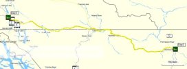
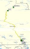
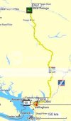
Day 1: 744km / 462mi - Abbotsford BC to Prince George BC.
Day01.jpg

IMG_0003.jpg
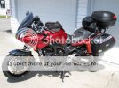
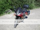
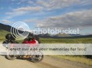
Bike loaded up and ready to roll. People always tell me the bike looks new.
IMG_0002.jpg
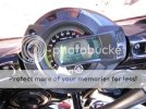
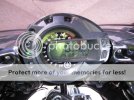
Starting Mileage. 85,168km / 52,921mi. A little bit of a late start to my day.
IMG_4285.jpg

IMG_4286.jpg

IMG_4288.jpg

IMG_4289.jpg

IMG_4291.jpg


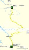
Day 2: 839km / 521mi - Prince George BC to Fort Nelson BC.
Day02.jpg

IMG_0004.jpg
 
Day 3: 988km / 614mi - Fort Nelson BC to Whitehorse YT.
Day03.jpg

IMG_0016.jpg

IMG_0017.jpg
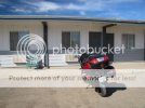
There was not a lot of places to stay in Fort Nelson. It is an oil/gas town and was packed with workers.
IMG_0018.jpg

IMG_0019.jpg

IMG_0020.jpg

IMG_4310.jpg

IMG_4311.jpg
Entering Stone Mountain Provincial Park.

IMG_0021.jpg
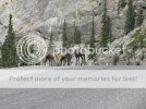
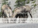
Mountain Goats.

IMG_0024.jpg
I'm guessing it was some tasty road salt on the side of the road that had their attention.
 
IMG_0037.jpg

IMG_4321.jpg

IMG_4322.jpg

IMG_0040.jpg

IMG_0041.jpg

IMG_0042.jpg
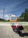
Sooooo when I first saw this sign I was a little surprised. It has to be the worst welcome to sign I have ever seen. Turns out it was not the actual provincial sign. The highway crosses back and forth over

the BC/Yukon border several times. So the actual sign isn't till further along

IMG_4323.jpg
I had seen at least a dozen bears already. Most run as you get near. I tried to snap a picture of this black bear as I rode by.

IMG_4324.jpg

IMG_0045.jpg
That's better! Welcome to the Yukon.

IMG_0046.jpg
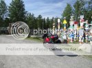
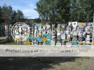
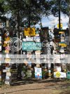
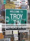
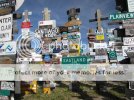
Sign Post Forest - Watson Lake Yukon. I believe they have over 30,000 signs here. Ranging from street signs to license plates.
 
IMG_0063.jpg

IMG_0064.jpg

IMG_0067.jpg

IMG_4330.jpg

IMG_4331.jpg

IMG_4332.jpg

IMG_4333.jpg

IMG_4335.jpg
Some where near this point i past through a long construction zone. The road had been dug up and was a mix of gravel sand and mud. They keep the ground wet to keep dust down as a pilot car leads you across. One section was so soft my tires bit in and I just about went down. I was second guessing myself after that as to if I should try ride the Dempster highway.

IMG_0068.jpg

IMG_0070.jpg
 
IMG_0071.jpg

IMG_0072.jpg

IMG_0073.jpg
At last! I was very excited to finally reach the start of the Dempster Highway. I decided that I would start out right away. It was only 7pm, so i figured I would ride till I felt like stopping.

IMG_0074.jpg
This sign is an stern reminder that one must behave while traveling the Dempster. Failure to do so could result in a very bad situation. You are basically on your own, with the exception of my Spot tracker

letting me call for help if needed.

IMG_0075.jpg
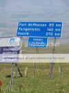
A mere 370km (230mi) to next fuel service. I was not really sure how far I could go on a tank. I know my range to be around 425km on average with highway riding. I worked out a absolute worst case fuel

mileage for a tank and figured out that bringing an extra 4L (1gal) would be more then enough.

The road has a couple of KM of pavement before it quickly turns to gravel. I had done extensive reading from others who had traveled this road on motorcycle. The highway is built upon a gravel pad that

has a thickness of 1.2 m (3 ft 11 in) up to 2.4 m (7 ft 10 in) in some places. The gravel pad is to prevent the road from sinking into the soft ground when the permafrost melts on the surface in the summer.

I'm guessing the pad insulates the ground bellow to allow it to stay frozen year round and thus not have the road sink. In many areas vehicles travel in the center and only move to the side to pass another vehicle. This makes the edges of gravel pad very soft in places, so you must be careful not to stray to close to the edge or your tire may sink into the uncompressed gravel.

IMG_0076.jpg
It wasn't long before I spotted a black bear running for cover. They really don't like having their picture taken.

IMG_0078.jpg
I had gone a few km of the gravel at a very cautious pace. I was coming to a small hill that I could not see over. As I approached I saw a very large cloud of dust being thrown in the air heading towards

me. Knowing that a vehicle was approaching I moved to the far right of the compressed section (avoiding the very soft shoulder). As I reached the crest a semi truck/trailer came FLYING over the top, it felt like he passed doing about 100km/h and within a few feet of me. I was SHOWERED in rocks that pelted me as high as my shoulders. That was a rather interesting experience - cant say I care to do that again. I saw 3 large trucks while on the Dempster. Its the way most goods are moved to Inuvik.

IMG_0080.jpg

IMG_0081.jpg

IMG_0082.jpg
 
IMG_0098.jpg

IMG_4336.jpg

IMG_0099.jpg

IMG_0100.jpg

IMG_0101.jpg

IMG_0103.jpg

IMG_0105.jpg

IMG_0106.jpg
Squinting into the sun.

IMG_0107.jpg
Everywhere you look there seems to be great photo opportunities. The pictures by no means even come close to doing justice. This place is just breathtaking!

IMG_0113.jpg
 
IMG_0126.jpg

IMG_0128.jpg

IMG_0129.jpg

IMG_0130.jpg

IMG_0131.jpg

IMG_0133.jpg
This is a runway for small aircraft. Can't you tell?

IMG_0135.jpg
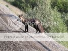
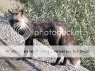
This arctic fox was sitting on the road. As I approached he ran off and around behind me.

IMG_0136.jpg
Arctic fox change color from white in the winter to brown in the summer.

IMG_0137.jpg

IMG_0141.jpg
Once he put a little distance between us he resumed relaxing on the road.
 
IMG_0143.jpg

IMG_0144.jpg

IMG_0146.jpg

IMG_0147.jpg

IMG_0148.jpg
The road was really wide at the top of this pass. I had stopped to take some photos and walked away from my bike. Let me tell you, one feels VERY VERY small out here.

IMG_0150.jpg
This moose sat still just long enough to get my camera out.

IMG_0151.jpg

IMG_0152.jpg

IMG_0153.jpg
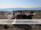
At this point I began looking for a suitable place to camp for the night. It didn't take long to find a secluded spot off the road on the top of a hill. By now it was midnight.

IMG_0158.jpg
This is what 12:05am look like in July under the land of the midnight sun. How cool is that!?
 
IMG_0160.jpg

IMG_0164.jpg
Looking out away from the sun at my camping spot.

IMG_0168.jpg

IMG_0170.jpg

IMG_0174.jpg
I put bug spray on my hands and wore a mosquito net over my head. The mosquitoes have a voracious appetite. I had to walk away from my tent and then run back and get in quickly to try not end up with any in my tent. It didn't take me to long to fall asleep once I got use to hearing the buzz of the many mosquitoes trying to get in my tent. What a day!


Day 5: 700km / 435mi - Dempster Hwy (km 254) to Dempster Hwy/Klondike Hwy.

Day05.jpg

IMG_0178.jpg
Good morning! I awoke at about 9:00am. By then the sun had moved across the horizon to start its slow journey again.

IMG_0179.jpg

IMG_0176.jpg
This thing is called a bear vault. You put your food, deodorant, toothpaste and other items inside that could attract bears. Its a hard plastic container that should be grizzly proof. You store it a good distance from your camp so as to keep the bears away from you that do do try get in it. I had bear bangers and bear spray with me as well.
 
IMG_0180.jpg
Time to hit the road.

IMG_0181.jpg
Fireweed lines much of the road you travel. It often grows where there have been forest fires or the ground has been disturbed.

IMG_0183.jpg

IMG_0184.jpg

IMG_0185.jpg

IMG_0186.jpg

IMG_0187.jpg

IMG_0188.jpg
Eagle Plains! The first fuel stop along the Dempster highway. They have a restaurant and hotel here as well.

IMG_0190.jpg
In the end I did not require ANY of the extra fuel I had brought. I was surprised as I spent a fair amount of time idling while taking pictures. And even a little backtracking.

IMG_0191.jpg
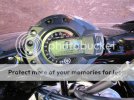
Distance since last fuel stop.
 
I had no cell phone service since leaving Whitehorse. But the Eagle Plains hotel/restaurant had WiFi. They get their data connection from a microwave antenna system that links the northern communities to the outside world. I find it amazing that you can be somewhere so remote, and yet still be able to e-mail a few pictures to family/friends.

IMG_0192.jpg

IMG_0195.jpg

IMG_0196.jpg

IMG_0198.jpg

IMG_0199.jpg
Just about to the edge of the arctic circle.

IMG_0252.jpg
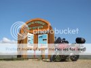
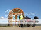
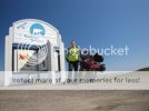
Hooray! I don't think there have been to many FZ6's to travel here before me.

IMG_0253.jpg
These two pictures were actually taken on my way back down. As when I arrived at the marker there were several people hanging around in all the pictures.

IMG_0200.jpg

IMG_0206.jpg
Continuing northward.

IMG_0208.jpg
 
IMG_0209.jpg

IMG_0212.jpg

IMG_0214.jpg

IMG_0216.jpg

IMG_0217.jpg

IMG_0224.jpg
Welcome to the Northwest Territories! Another goal of my trip completed.

IMG_0227.jpg
Apparently birds from as far as northern Africa migrate up the the arctic circle in the summer.

IMG_0219.jpg
How far to go to the end of the line.

IMG_0228.jpg

IMG_0229.jpg
 
Back
Top